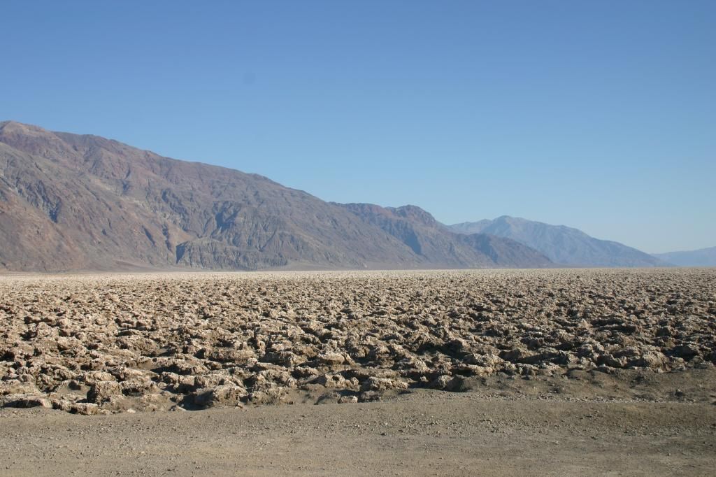
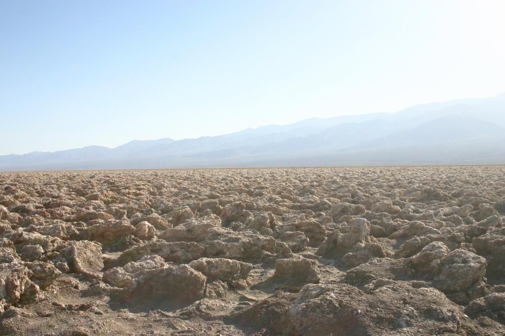
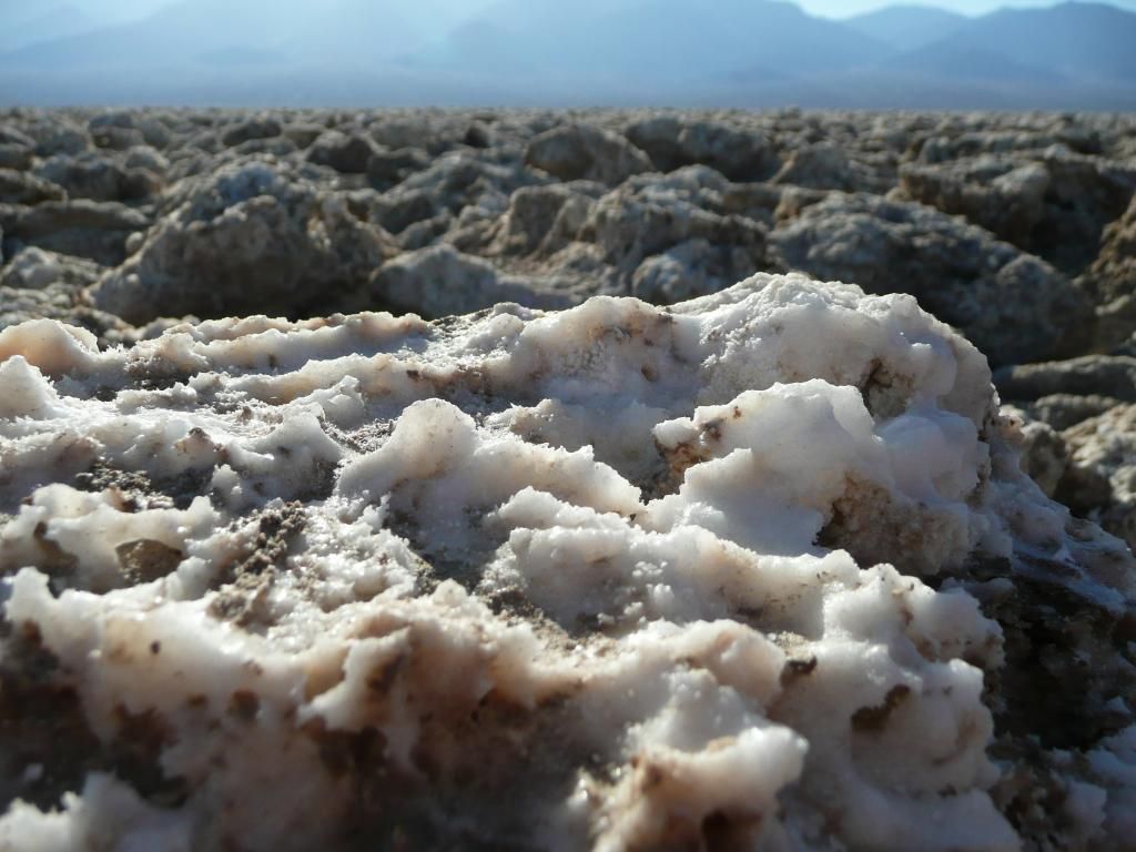
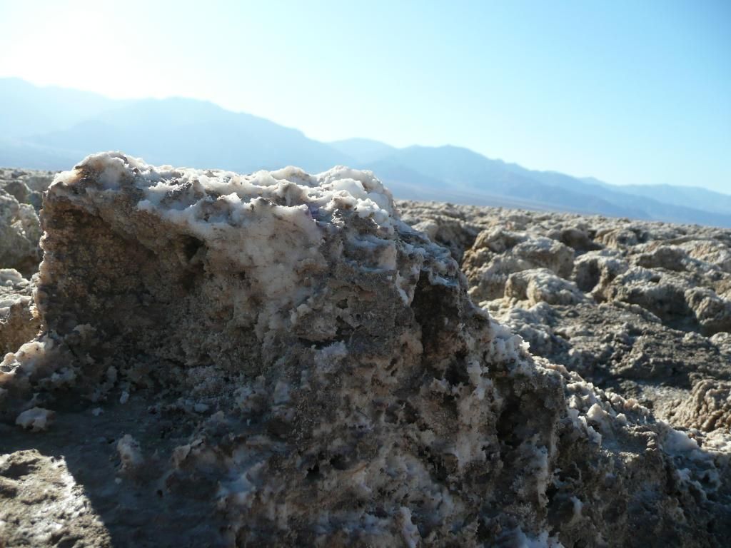
Death Valley is home to many interesting geological features which include the Devil’s Golf Course (a landscape of crystallised salt beds) and the famous Racetrack Playa, where the “Sailing Stones” glide along the desert floor leaving tracks behind them.
Another geological feature of Death Valley that is worthy of mention is Ubehebe Crater.
Ubehebe Crater can be found in the northern part of Death Valley, at the northern edge of the Cottonwood Mountains. The crater measures in at 1,000m wide and up to 237m deep and its estimated age lies in the range of 800 to 7,000 years of age. Ubehebe crater is not an impact crater created by an astronomical object falling to earth, but is instead a volcanic crater. Magma rising from below ground would have come into contact with ground water, which would have explosively turned into steam. This explosion ejected bedrock and other material which created the crater. Ubehebe Crater is not the only crater in the immediate area created by this process, but is by far the most impressive.
Pictures, California (2008).
If you find this post interesting please share it using the buttons below.
“Random encounters with the unusual” is a repository for the oddities that me and Mrs J have encountered on our travels, which we find interesting or amusing in some way. Have a look, maybe you will find something interesting or amusing herein.
Showing posts with label California. Show all posts
Saturday, 1 February 2014
Sunday, 21 July 2013
Alcatraz’s Weird Residents
The former prison on Alcatraz Island is well known for some of its famous residents, which included Al Capone, Robert “Birdman” Stroud and George “Machine Gun” Kelly (amongst others). The prison closed in 1963 and by the end of that decade the island had become home to a number of Native American activists who stayed for around two years. The island is also reported to be home to a number of ghosts of the former prison inmates.
The weirdest Alcatraz Island resident by far however, is far smaller and more inconspicuous than any of these.
Back in 2012 the island was suffering from a rat infestation, and in a bid to control this problem a dye that fluoresces under ultraviolet light was put into bait. The plan being that the rat’s droppings could then be tracked using UV lights and the rats could be found and eliminated. However, the pest controllers found more than just glowing rat droppings, they found glowing millipedes. It seems that by accident the pest controllers had found an unusual trait of the island’s known species of millipedes, that when illuminated by UV light, that they fluoresce. It is not entirely clear why a mostly nocturnal and blind animal would evolve to emit light, but one theory is that it could be a mechanism to warn predators not to eat them (as they are toxic).
Pictures, California (2008).
If you find this post interesting please share it using the buttons below.
The weirdest Alcatraz Island resident by far however, is far smaller and more inconspicuous than any of these.
Back in 2012 the island was suffering from a rat infestation, and in a bid to control this problem a dye that fluoresces under ultraviolet light was put into bait. The plan being that the rat’s droppings could then be tracked using UV lights and the rats could be found and eliminated. However, the pest controllers found more than just glowing rat droppings, they found glowing millipedes. It seems that by accident the pest controllers had found an unusual trait of the island’s known species of millipedes, that when illuminated by UV light, that they fluoresce. It is not entirely clear why a mostly nocturnal and blind animal would evolve to emit light, but one theory is that it could be a mechanism to warn predators not to eat them (as they are toxic).
| Alcatraz Island in San Fransisco Bay. |
| Alcatraz Island up close. |
| The prison. |
| The prison. |
| Graffiti from the Native American Occupation. |
| A cell block. |
| A cell. |
| An example "tunnel" from the Alactraz prison escape. |
| The "service tunnel" behind the cells into which the escapees fled. |
| Prison Medical Ward. |
| A cell block. |
| San Fransisco at night as seen from Alcatraz Island. |
If you find this post interesting please share it using the buttons below.
Friday, 5 April 2013
Hunting for Alien Life in California
Pictured below is Mono Lake, which is a highly saline lake near the town of Lee Vining in California (about 75 miles by road from Yosemite National Park and 35 miles from the Ghost Town of Bodie).
Mono Lake is believed to have formed at least 760,000 years ago and is thought to be a remnant of a much larger and older lake that once covered a large part of Nevada and Utah. It is estimated that at its peak (during the most recent ice age) the lake may have been around 270 m deep. Old shore lines which show the previous extent of the lake (known as strandlines) can be seen above the town of Lee Vining and along the hills to the northeast of the current lake.
Because Mono Lake now has no outlet to the sea, high levels of salt have become dissolved in the water over time and this has resulted in the lake becoming highly alkaline. Depending on the water level, the lake is typically seen to be two to three times more salty than the sea. Despite this high alkalinity the lake is still home to life and the most complex creature that resides within the lake is a form a brine shrimp.
Mono lake is of particular interest to astrobiologists as the extreme conditions in the lake give them the opportunity to study how life could potentially evolve and exist on other planets. In 2010 a study claimed that a form of bacteria had been found in Mono Lake that could use arsenic as one of its building blocks, in place of phosphorus - the current understanding of biochemistry being that all life comprises of at least the six elements carbon, hydrogen, oxygen, nitrogen, sulphur and phosphorus. If this claim was indeed true then the implication was that life could have potentially formed on earth (and other planets) in a radically different way to what is currently accepted.
These claims were unfortunately short lived however, with two further studies suggesting that the bacteria in question still needed to use phosphorus to grow, and that they did not break the current accepted model of biochemistry.
So it seems that Mono Lake may not be a home to “alien life” on Earth, but the search for a “shadow biosphere” will no doubt continue and the focus is likely to remain on extreme environments (like that of Mono Lake) where unknown forms of life may have carved out a niche for themselves.
Pictures of Mono Lake have also featured on Andrew May’s Forteana Blog
Pictures, California (2008).
If you find this post interesting please share it using the buttons below.
Mono Lake is believed to have formed at least 760,000 years ago and is thought to be a remnant of a much larger and older lake that once covered a large part of Nevada and Utah. It is estimated that at its peak (during the most recent ice age) the lake may have been around 270 m deep. Old shore lines which show the previous extent of the lake (known as strandlines) can be seen above the town of Lee Vining and along the hills to the northeast of the current lake.
Because Mono Lake now has no outlet to the sea, high levels of salt have become dissolved in the water over time and this has resulted in the lake becoming highly alkaline. Depending on the water level, the lake is typically seen to be two to three times more salty than the sea. Despite this high alkalinity the lake is still home to life and the most complex creature that resides within the lake is a form a brine shrimp.
Mono lake is of particular interest to astrobiologists as the extreme conditions in the lake give them the opportunity to study how life could potentially evolve and exist on other planets. In 2010 a study claimed that a form of bacteria had been found in Mono Lake that could use arsenic as one of its building blocks, in place of phosphorus - the current understanding of biochemistry being that all life comprises of at least the six elements carbon, hydrogen, oxygen, nitrogen, sulphur and phosphorus. If this claim was indeed true then the implication was that life could have potentially formed on earth (and other planets) in a radically different way to what is currently accepted.
These claims were unfortunately short lived however, with two further studies suggesting that the bacteria in question still needed to use phosphorus to grow, and that they did not break the current accepted model of biochemistry.
So it seems that Mono Lake may not be a home to “alien life” on Earth, but the search for a “shadow biosphere” will no doubt continue and the focus is likely to remain on extreme environments (like that of Mono Lake) where unknown forms of life may have carved out a niche for themselves.
Pictures of Mono Lake have also featured on Andrew May’s Forteana Blog
Pictures, California (2008).
If you find this post interesting please share it using the buttons below.
Wednesday, 27 February 2013
The Devil’s Golf Course
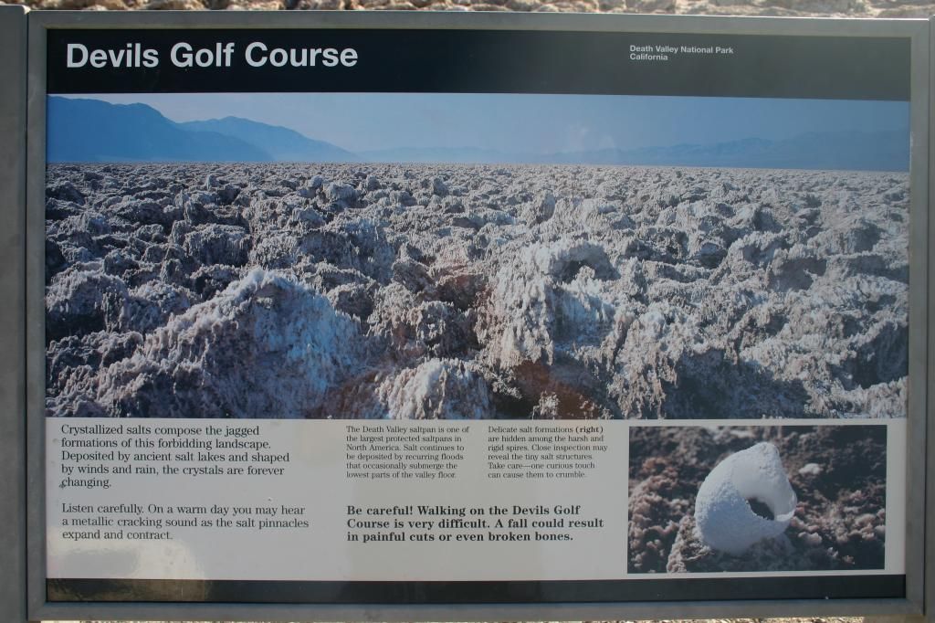
The Devil's Golf Course is a salt flat in Death Valley (part of the Mojave Desert), where crystallised salts form a complex and jagged landscape which fill the valley as far as the eye can see. The valley was once home to a lake, and it was the evaporation of this lake over the centuries that led to the salt formations being left behind.
The salt formations that comprise The Devil’s Golf Course are ever changing, and are continually sculpted by the weather. Apparently, if you listen closely on a warm day the expansion and contraction of the salt pinnacles can lead to a metallic cracking sound being heard.
The salt beds are believed to be extensive, with some studies suggesting that their depth ranges from 300m to 2,700m in places.
Pictures, California (2008).
If you find this post interesting please share it using the buttons below.
The salt formations that comprise The Devil’s Golf Course are ever changing, and are continually sculpted by the weather. Apparently, if you listen closely on a warm day the expansion and contraction of the salt pinnacles can lead to a metallic cracking sound being heard.
The salt beds are believed to be extensive, with some studies suggesting that their depth ranges from 300m to 2,700m in places.
![]() |
| The Devil's Golf Course. |
![]() |
| The Devil's Golf Course. |
![]() |
| Salt formation close up. |
![]() |
| Salt formation close up. |
![]() |
| Notice board. |
![]() |
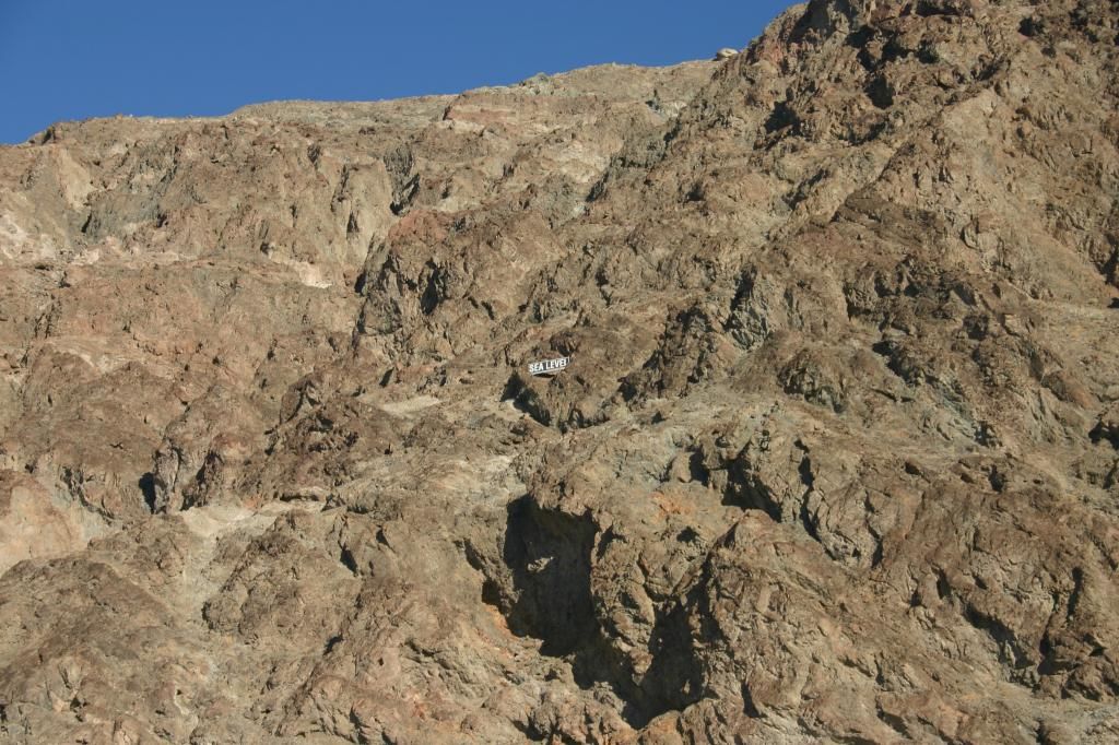
| A sign showing sea-level. |
![]() |
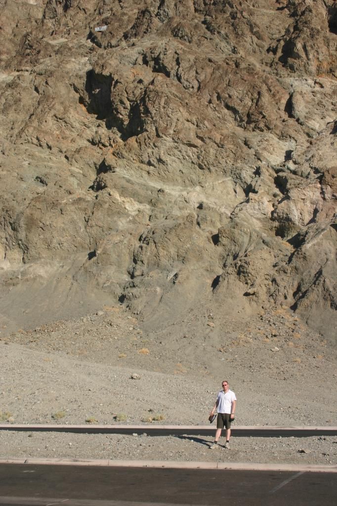
| Mr Fox, approximately 85m below sea level, but still dry! |
If you find this post interesting please share it using the buttons below.
Thursday, 15 November 2012
Ghost Towns
On our travels Mrs J and I have visited a number of ghost towns, some supposedly haunted, some not. They all however share a mysterious air, as they are essentially towns that have been frozen in time. Below is a short history of the ghost towns that we have visited.
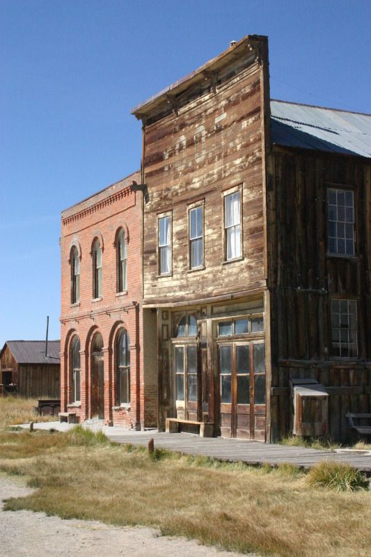
Bodie
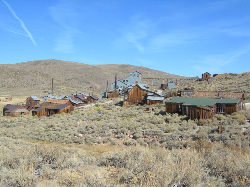
Bodie is an abandoned town that lies east of the Sierra Nevada mountain range in California at a wind-swept elevation of 2,554m. Bodie began life in 1859 as a small mining camp following the discovery of gold by a group of prospectors, which included W. S. Bodey (whom the town was ultimately named after). In 1876 further deposits of gold ore were found, which facilitated Bodie’s transformation from a small mining camp into a Wild West boomtown. Continuing discoveries of gold enticed more people to the town and by 1879 Bodie had a population of approximately 5,000 to 7,000 people, and consisted of around 2,000 buildings.
Bodie’s demise as a town began in 1880, when miners began to drift off towards other more prosperous boomtowns. By 1910 the population was recorded at 698 people, and by 1920 it had fallen to around 120. The final nail in Bodie’s coffin seemed to occur in 1942, when due to the war, all non-essential gold mines in the USA were closed.
Pictures of Bodie have previously featured in Andrew May’s Forteana Blog.
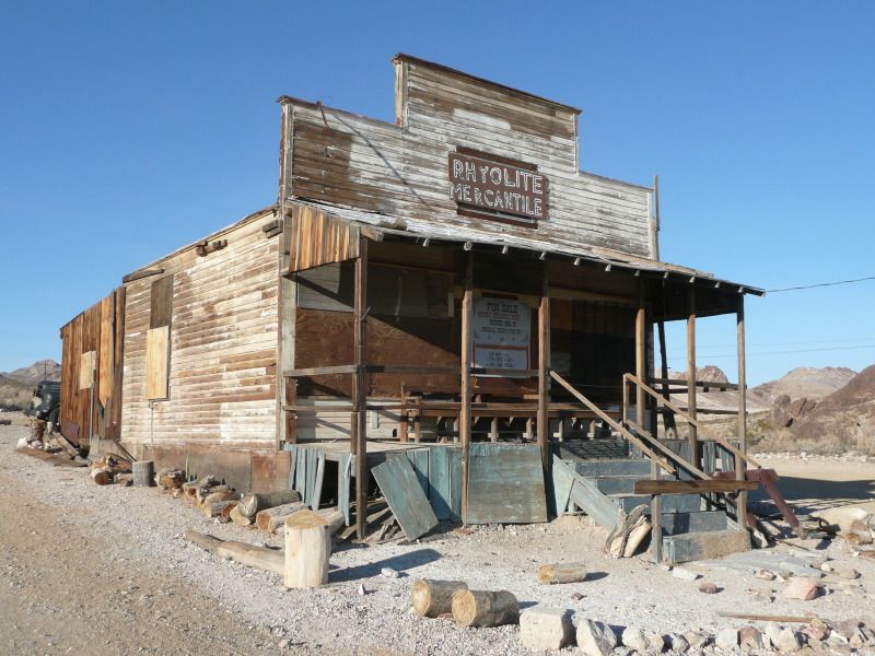
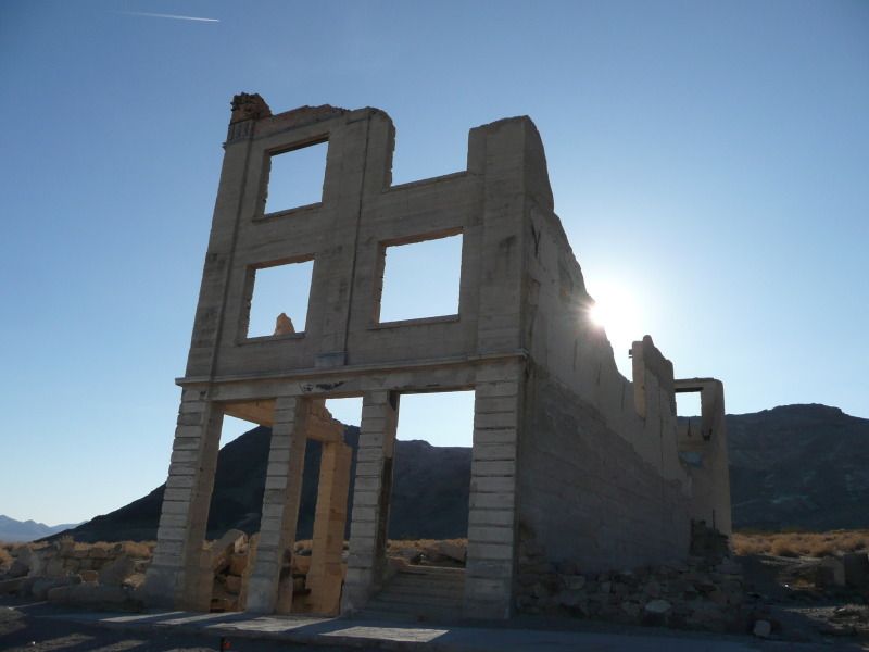
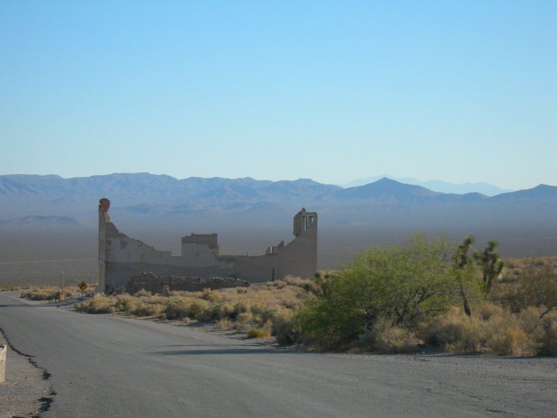
Rhyolite
Rhyolite is an abandoned town which lies at an elevation of 1,200m in the Bullfrog Hills in Nevada, about 120 miles northwest of Las Vegas, near the edge of Death Valley.
In August 1904, prospectors found gold on the side of Bullfrog Mountain and word of this discovery soon spread, and shortly afterwards thousands of hopeful prospectors rushed in to the area. This sudden influx of people lead to settlements being established near the mines and Rhyolite became the largest of them. Starting as a two-man camp in January 1905, Rhyolite became a town of 1,200 people in two weeks and reached a population of 2,500 by June 1905. By which point it was a significant town with 50 saloons, 19 lodging houses, 16 restaurants, half a dozen barbers, and even a weekly newspaper. By 1907 the population had increase further to about 4,000 to 5,000 people and the town now boasted concrete sidewalks, electric lights, water mains, telephone and telegraph lines, daily and weekly newspapers, a monthly magazine, police and fire departments, a hospital, school, train station and railway depot, at least three banks, a stock exchange, an opera house, a public swimming pool and two formal church buildings.
The town’s decline was nearly as fast as its boom, and by 1909 the mines had stop producing new gold ore and by March 1911 the gold rush was over. The town’s population decline mirrored this drop in gold production and by 1910 the population had dropped to only 675 residents. All three of the town’s banks had closed by March 1910 and the post office followed suit in November 1913. The last train left Rhyolite Station in July 1914, and the Power Company turned off the electricity and removed its power lines in 1916. By 1920 the town’s population was only 14 people, and the last remaining resident was reported to have died in 1924.
Imber
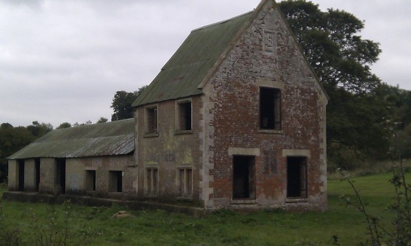
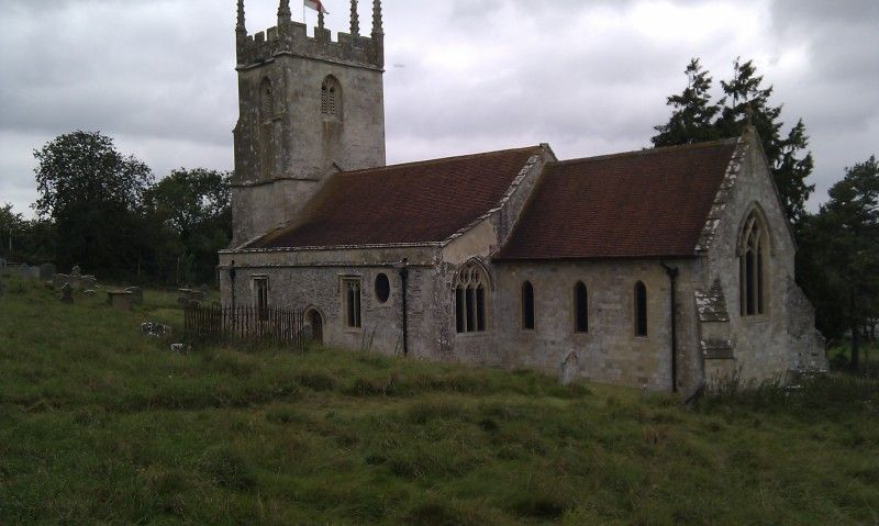
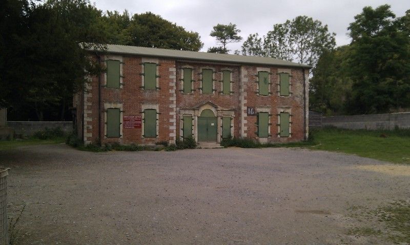
Imber is an uninhabited village which today forms part of the Army training ground on Salisbury Plan in Wiltshire. Imber had existed as a settlement for many centuries, with the first documented mention of the village coming from 967. Imber is also mentioned in the Domesday book (1086), at which time the population was around 50 persons. By the 1300’s the population of the village had risen to around 250, where it is believed to have remained until the 1800’s. The population peaked at 440 as recorded in the census of 1851, declining to around 150 by the time of Imber's abandonment.
Imber’s abandonment was a result of the war effort during the Second World War In November 1943, while the Allied forces made preparations for the invasion of Europe, the people of Imber were called to a meeting in the village schoolroom and given 47 days' notice to leave their homes. Imber was to be abandoned to allow the US forces to practice Urban Warfare prior to the planned invasion of Europe. The villagers after being assured that they could return to their homes within six months, left the village with no resistance, however they were never allowed to return, and the town continues to be used for military training today.
Pictures of Imber have previously featured in Andrew May’s Forteana Blog.
Pictures California & Nevada (2008) and Wiltshire (2011).
Bodie
Bodie is an abandoned town that lies east of the Sierra Nevada mountain range in California at a wind-swept elevation of 2,554m. Bodie began life in 1859 as a small mining camp following the discovery of gold by a group of prospectors, which included W. S. Bodey (whom the town was ultimately named after). In 1876 further deposits of gold ore were found, which facilitated Bodie’s transformation from a small mining camp into a Wild West boomtown. Continuing discoveries of gold enticed more people to the town and by 1879 Bodie had a population of approximately 5,000 to 7,000 people, and consisted of around 2,000 buildings.
Bodie’s demise as a town began in 1880, when miners began to drift off towards other more prosperous boomtowns. By 1910 the population was recorded at 698 people, and by 1920 it had fallen to around 120. The final nail in Bodie’s coffin seemed to occur in 1942, when due to the war, all non-essential gold mines in the USA were closed.
Pictures of Bodie have previously featured in Andrew May’s Forteana Blog.
Rhyolite
Rhyolite is an abandoned town which lies at an elevation of 1,200m in the Bullfrog Hills in Nevada, about 120 miles northwest of Las Vegas, near the edge of Death Valley.
In August 1904, prospectors found gold on the side of Bullfrog Mountain and word of this discovery soon spread, and shortly afterwards thousands of hopeful prospectors rushed in to the area. This sudden influx of people lead to settlements being established near the mines and Rhyolite became the largest of them. Starting as a two-man camp in January 1905, Rhyolite became a town of 1,200 people in two weeks and reached a population of 2,500 by June 1905. By which point it was a significant town with 50 saloons, 19 lodging houses, 16 restaurants, half a dozen barbers, and even a weekly newspaper. By 1907 the population had increase further to about 4,000 to 5,000 people and the town now boasted concrete sidewalks, electric lights, water mains, telephone and telegraph lines, daily and weekly newspapers, a monthly magazine, police and fire departments, a hospital, school, train station and railway depot, at least three banks, a stock exchange, an opera house, a public swimming pool and two formal church buildings.
The town’s decline was nearly as fast as its boom, and by 1909 the mines had stop producing new gold ore and by March 1911 the gold rush was over. The town’s population decline mirrored this drop in gold production and by 1910 the population had dropped to only 675 residents. All three of the town’s banks had closed by March 1910 and the post office followed suit in November 1913. The last train left Rhyolite Station in July 1914, and the Power Company turned off the electricity and removed its power lines in 1916. By 1920 the town’s population was only 14 people, and the last remaining resident was reported to have died in 1924.
Imber
Imber is an uninhabited village which today forms part of the Army training ground on Salisbury Plan in Wiltshire. Imber had existed as a settlement for many centuries, with the first documented mention of the village coming from 967. Imber is also mentioned in the Domesday book (1086), at which time the population was around 50 persons. By the 1300’s the population of the village had risen to around 250, where it is believed to have remained until the 1800’s. The population peaked at 440 as recorded in the census of 1851, declining to around 150 by the time of Imber's abandonment.
Imber’s abandonment was a result of the war effort during the Second World War In November 1943, while the Allied forces made preparations for the invasion of Europe, the people of Imber were called to a meeting in the village schoolroom and given 47 days' notice to leave their homes. Imber was to be abandoned to allow the US forces to practice Urban Warfare prior to the planned invasion of Europe. The villagers after being assured that they could return to their homes within six months, left the village with no resistance, however they were never allowed to return, and the town continues to be used for military training today.
Pictures of Imber have previously featured in Andrew May’s Forteana Blog.
Pictures California & Nevada (2008) and Wiltshire (2011).
Subscribe to:
Posts (Atom)